Garmin eTrex 22x
4.3Editor score
Sunlight-readable 2.2-inch display
TopoActive routable maps
GPS and GLONASS support
A handheld rugged GPS navigator with maps is built for people who need dependable positioning away from reliable cellular coverage. The best models combine accurate multi-constellation tracking, readable outdoor displays, durable construction, useful topographic detail, and batteries capable of supporting long days or multiday trips.
This guide compares ten navigators based on screen visibility, mapping options, satellite support, navigation sensors, water resistance, memory, battery options, connectivity, and field-friendly controls. The list covers compact two-AA models, rechargeable touchscreens, and premium units with satellite communication, allowing readers to compare different needs without relying on a single specification.
Each review explains what the featured model does best, where it may fall short, and the type of outdoor user it suits. Ratings and supplied product details reflect the available listings, while features, bundle contents, and commercial terms can change. Readers should confirm current specifications and accessories before making a final purchase.
4.3Editor score

3.9Editor score

4.3Editor score
As an Amazon Associate we earn from qualifying purchases.
The comparison below highlights the most important differences among ten rugged GPS navigators, including display size, mapping capabilities, satellite reception, water resistance, and battery configuration. It is designed to make the strongest choices easier to identify for hiking, backpacking, geocaching, off-road travel, and expedition use.




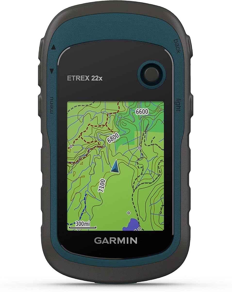
The Garmin eTrex 22x is a compact, conventional handheld GPS that combines a readable color display, preloaded topographic maps, and dual-constellation positioning. Its 4.3 rating reflects broad appeal among hikers and cyclists who want dependable navigation without a large touchscreen. The 2.2-inch screen is modest, but its sunlight readability makes it practical in exposed outdoor environments.
We may earn a commission when you buy through this link, at no additional cost to you.
TopoActive maps include routable roads and trails for hiking and cycling, while support for GPS and GLONASS can improve tracking in challenging terrain. The device includes 8 GB of internal memory and a microSD card slot for additional map downloads. Two AA batteries provide up to 25 hours in GPS mode, making spare cells a practical part of longer trips.
The main limitation is screen area. Detailed maps, menus, and track information take more effort to inspect on a 2.2-inch display than on a modern touchscreen. The eTrex 22x also lacks the 3-axis compass and barometric altimeter found on the eTrex 32x, so buyers who value an electronic heading or elevation readings should consider that alternative.
It is best for hikers, cyclists, and casual outdoor users who want a simple, durable navigator with maps already installed. The physical buttons also remain useful when cold, wet, or gloved hands make touch operation awkward. For most buyers seeking a balanced and economical entry into dedicated handheld navigation, the eTrex 22x is the strongest general-purpose pick in this guide.
Garmin's physical-button layout reduces the learning curve for users coming from a phone or another simple GPS. Menus and navigation functions remain accessible without relying entirely on a touchscreen, while the preloaded TopoActive coverage provides useful trail and road guidance from the outset.
Eight gigabytes of internal memory handles the supplied mapping, while the microSD slot allows additional downloads when travelers need more regional detail. The stated 25-hour GPS runtime also offers a straightforward way to extend field time by carrying replacement AA batteries.
We may earn a commission when you buy through this link, at no additional cost to you.
This compact handheld GPS stands out through its 3.2-inch sunlight-readable screen, broad multi-GNSS support, and USB-C rechargeable battery. Its 3.9 rating indicates a generally positive but less established customer history than the leading Garmin models. The combination of physical buttons and a relatively large display makes it appealing for users who want modern features without abandoning tactile controls.
We may earn a commission when you buy through this link, at no additional cost to you.
The receiver supports GPS, Galileo, BeiDou, and QZSS, and the supplied description states positioning precision within six feet. A 3-axis compass and barometric altimeter provide a digital heading even while stationary and add elevation information to the navigation experience. Preloaded USA topographic maps support hiking and camping, and 32 GB of internal memory leaves substantial room for downloads.
Its IP66 water-resistance rating, anti-slip design, and claimed 36-hour battery life emphasize field readiness. Nevertheless, IP66 covers protection from dust and powerful water jets rather than unlimited submersion, and map availability outside the United States may require downloads. The product also lacks a long, established review history, so potential buyers should examine the listing and current feedback carefully.
This navigator suits hikers and campers who prioritize a large display, multiple satellite systems, and a rechargeable setup. It may be especially attractive to users who find small screens difficult to navigate. The trade-off is a less established rating and a less familiar product name, but the stated hardware specifications are well suited to outdoor navigation.
Access to four major satellite systems can make the unit useful in canyons, wooded terrain, and other places where relying on one constellation may be less dependable. The included compass and altimeter add information beyond the basic position marker, although real-world accuracy also depends on conditions and satellite visibility.
Charging through USB-C removes the need to carry a dedicated battery format. The stated 36-hour runtime offers a generous working window for typical outings, while the physical controls can be easier to use than a touchscreen when moisture, cold, or gloves interfere with touch response.
We may earn a commission when you buy through this link, at no additional cost to you.
The Garmin eTrex 32x builds on the compact eTrex formula by adding a 3-axis compass and barometric altimeter. With a 4.2 rating, it is a well-regarded choice for hikers who want navigation tools beyond a basic position and route display. Its familiar physical controls and 2.2-inch sunlight-readable screen prioritize dependable operation over modern visual polish.
We may earn a commission when you buy through this link, at no additional cost to you.
TopoActive maps provide roads and trails for cycling and hiking, while GPS and GLONASS support improve positioning options in challenging areas. The compass can show heading while standing still, and the altimeter supplies elevation information. Eight gigabytes of internal memory and a microSD slot provide room for additional regional map downloads when the included coverage is not sufficient.
Compared with the eTrex 22x, the extra sensors make the 32x better suited to routes involving elevation changes, orientation, or stationary navigation. It still has a small screen and lacks a touchscreen, so users who need to pan around detailed maps may prefer a larger model. Two AA batteries provide up to 25 hours in GPS mode.
This is a strong choice for hikers, backpackers, and cyclists who prefer physical controls and want basic navigation sensors in a compact unit. It also makes sense as an upgrade for someone familiar with the eTrex 22x. The trade-off is the small display, but the added compass and altimeter provide practical value without adding a complicated interface.
The barometric altimeter adds elevation context that can be useful when navigating steep routes or identifying changes in altitude. It also gives the unit more capability than a basic position-only device, making it a versatile companion for hikers who want to monitor route progress beyond distance remaining.
The 3-axis electronic compass can maintain a heading when the user is stationary, unlike a simple pointer that depends on movement. This is useful while surveying a junction, checking a bearing, or orienting the map before beginning the next section of a route.
We may earn a commission when you buy through this link, at no additional cost to you.
The Garmin eTrex Touch combines a compact 3-inch touchscreen with multi-band GPS, detailed preloaded maps, and an IP67 water rating. Its 3.9 rating makes it a credible modern alternative to button-led eTrex devices. The defining benefit is smoother map exploration: users can swipe and zoom directly on a bright, high-resolution color display.
We may earn a commission when you buy through this link, at no additional cost to you.
Terrain contours, topographic elevations, summits, parks, coastlines, rivers, lakes, and geographic points are included. Popularity routing and round-trip routing help users create practical routes, while ascent planning highlights upcoming climbs and their steepness. Garmin Explore compatibility supports trip planning and review of waypoints, courses, and activities from a phone or tablet.
The rechargeable battery is rated for up to 130 hours in all-satellite and multi-band mode under typical SatIQ use, with a much longer stated expedition figure. Wi-Fi can add premium map content through a separately sold Outdoor Maps+ plan. The touchscreen may be less convenient with wet or gloved hands, and optional connectivity and mapping services add considerations beyond the initial device.
The eTrex Touch is best for hikers who want a modern interface without moving to a much larger unit. It also suits travelers who value multi-band positioning and detailed route-planning features in a rugged package. For users who require physical buttons in every situation, the eTrex 32x remains the clearer choice, but the Touch is our top touchscreen recommendation.
The 3-inch screen offers more room for examining contours and route intersections than the 2.2-inch eTrex models. Direct swipe-and-zoom controls make it easier to move around a regional map, identify nearby points of interest, and review route details without navigating through a dense sequence of menus.
The stated 130-hour battery figure in all-satellite and multi-band mode makes the Touch well suited to travel where every carryable item matters. The much longer expedition-mode allowance adds flexibility for remote travel, although actual runtime depends on settings, temperature, and use.
We may earn a commission when you buy through this link, at no additional cost to you.
The S190 is a large-screen handheld GPS with a 3.9-style feature set tailored to hiking and camping, including a 3.2-inch sunlight-readable color display and 64 GB of internal memory. Its 5.0 rating is the highest listed in this roundup, although a smaller review base can make a perfect average less predictive than a longer-established history.
We may earn a commission when you buy through this link, at no additional cost to you.
It connects to GPS, BeiDou, Galileo, and QZSS satellites, records the traveled route, and can guide users back along the same path. A 3-axis compass displays heading while stationary. Preloaded USA topographic maps and a worldwide basemap provide initial navigation coverage, and the generous internal memory offers room to download more detailed regional files.
The most important caveat is the map zoom tier described in the product information. The map can become blank when zoomed in further because the preloaded state map has limited detail; full-resolution files can be downloaded using instructions in the product video and manual. IP64 protection is designed for splashes and outdoor exposure rather than the more demanding water protection associated with IP67.
This unit is best for hikers who prefer a large screen, broad satellite support, and plentiful storage for downloaded maps. It is particularly relevant for travelers willing to complete the map-download process before a trip. Buyers should not mistake the high rating for permission to skip that preparation, because local map detail depends on the files actually installed.
A 3.2-inch color screen provides more room for reading terrain and route information, while 64 GB gives downloaded maps considerable space. That combination can reduce the need to repeatedly manage files during a trip, although users should still prepare maps before heading into remote areas.
The supplied notes explain that the preloaded state-level map has a limited zoom tier. Downloading the appropriate detailed files before departure is essential for close inspection of trails, landmarks, and route junctions, particularly where users expect to navigate at a fine scale.
We may earn a commission when you buy through this link, at no additional cost to you.
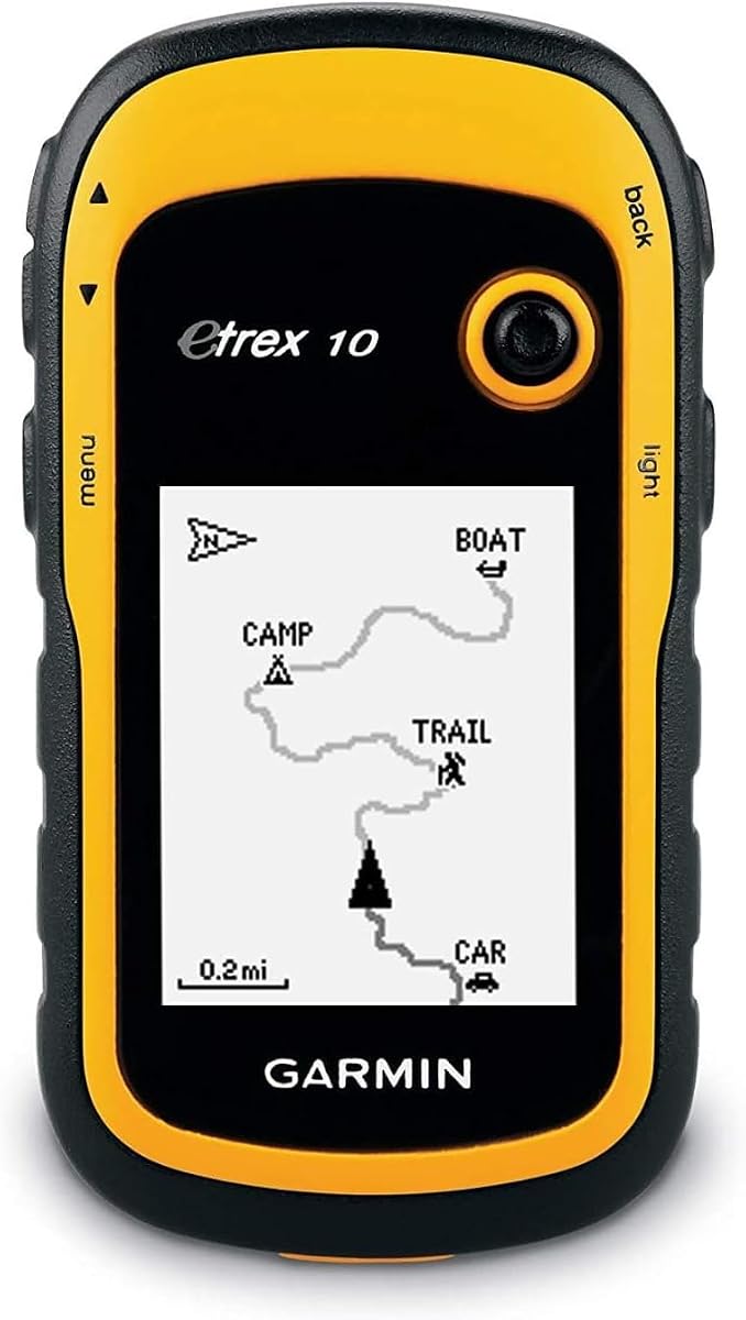
The Garmin eTrex 10 is a straightforward worldwide GPS for users who need more capability than a basic coordinate locator but do not require a large color display or elaborate route features. Its 4.3 rating and long-standing position in the Garmin handheld range make it a recognizable choice for basic navigation, travel, and paperless geocaching.
We may earn a commission when you buy through this link, at no additional cost to you.
A preloaded worldwide basemap and 2.2-inch monochrome screen keep the device focused and easy to understand. The WAAS-enabled receiver includes HotFix and GLONASS support for positioning, while IPX7 water resistance helps protect against rain and splashes. Users can store waypoints and inspect high and low elevation points to estimate time and distance between saved locations.
The monochrome display is less effective for distinguishing rich terrain detail, and the worldwide basemap is not the same as detailed regional topographic mapping. Its stated battery life of up to 20 hours is shorter than that of many newer alternatives. These limitations make the eTrex 10 less suitable for users who want satellite imagery, modern touch navigation, or extensive downloadable maps.
It is best for casual hikers, travelers, and geocachers who value simplicity, worldwide base coverage, and rugged construction over sophisticated route displays. A paperless geocaching setup also makes it attractive to users whose priorities are coordinates and cache data. The eTrex 22x is the stronger option for modern color mapping, while the eTrex 10 remains a disciplined choice for uncomplicated navigation.
The included worldwide basemap reduces the need to add a broad international map before travel. It is most useful for orientation, nearby landmarks, and general route awareness, while users needing trail-level detail should consider a model with more extensive downloadable topographic coverage.
Paperless geocaching is a major strength for users who want cache coordinates and related information without relying on a phone. The simple interface and compact form reduce distractions, making the device well suited to focused geocaching outings.
We may earn a commission when you buy through this link, at no additional cost to you.
The Garmin Montana 710 is a premium handheld navigator centered on a 5-inch glove-friendly color touchscreen. Its 4.3 rating reflects a strong combination of large-screen usability, detailed mapping, rugged construction, and modern connectivity. It is best suited to hikers, off-road travelers, and expedition users who want more visual information and route flexibility than a compact eTrex provides.
We may earn a commission when you buy through this link, at no additional cost to you.
TopoActive maps are included, with additional street and marine mapping available separately. Downloadable high-resolution satellite imagery gives users an overhead view of remote areas and allows waypoints to be placed around recognizable landmarks. Wi-Fi supports premium map downloads through a separate Outdoor Maps+ subscription, while 32 GB of internal memory provides substantial local storage.
The housing meets MIL-STD-810 standards for thermal, shock, and vibration and carries IPX7 water resistance. A rechargeable lithium-ion battery delivers up to 24 hours in GPS mode, with a much longer stated expedition runtime. AA batteries can also serve as a backup, although they are not included. Its size may feel cumbersome on fast hikes, but the readable display is valuable for complex navigation.
The Montana 710 is our premium recommendation for users who want a large, sensor-rich, connected navigator. It handles topographic routes, street navigation, satellite imagery, and expedition planning in one package. Compared with the touch-only eTrex Touch, it offers a much larger workspace and optional marine mapping, making it ideal for varied trips and vehicle-to-trail adventures.
The 5-inch display provides enough room to examine terrain, compare route alternatives, and read labels without constant zooming. Its glove-friendly design helps preserve the benefit of touch operation during cold-weather use, while physical power controls remain available through the device design.
TopoActive mapping handles outdoor navigation, while separately available City Navigator and BlueChart g3 options extend the device into street and marine environments. Satellite imagery adds another layer for identifying landmarks, which can be especially helpful in areas without extensive road access.
We may earn a commission when you buy through this link, at no additional cost to you.
The Garmin eTrex SE is built around endurance, compactness, and connected planning rather than a large display. Its 4.2 rating makes it a solid choice for hikers and geocachers who want a small navigator that can operate for extended periods. The standout specification is a stated battery life of up to 168 hours in standard mode and 1,800 hours in expedition mode.
We may earn a commission when you buy through this link, at no additional cost to you.
Multi-GNSS support covers GPS, GLONASS, Galileo, BeiDou, and QZSS, which expands satellite availability in difficult terrain. A digital compass provides heading even while stationary, and IPX7 water resistance handles wet conditions. The 2.2-inch high-resolution display is designed to remain readable in bright sunlight while preserving the rugged eTrex form factor.
When paired with a compatible smartphone, Garmin Explore enables wireless software updates, trip planning, weather information, smart notifications, and additional mapping. It can also retrieve descriptions, logs, and hints for geocaches through Geocaching Live. The tradeoff is that it does not include a detailed topographic map, and its small non-touch screen is less suitable for close visual inspection.
The eTrex SE is best for long expeditions, geocaching trips, and users who already rely on the Garmin ecosystem to plan and review activities. It may be less convenient for buyers who want a fully self-contained device with detailed maps already installed. For that reason, it serves as an endurance-focused alternative rather than the most straightforward general recommendation.
The eTrex SE can operate for many days in standard mode according to the supplied specification, and its expedition setting extends that potential dramatically. This reduces battery anxiety on long trips, while field-replaceable AA batteries make it possible to carry a reserve power source.
Garmin Explore transforms the compact device into part of a broader planning system for routes, waypoints, and activities. Because detailed map coverage is not listed as preloaded, users should confirm their preferred content and download it before entering areas with limited connectivity.
We may earn a commission when you buy through this link, at no additional cost to you.
The Garmin GPSMAP 67i is a renewed rugged GPS handheld with inReach satellite technology, two-way messaging, and interactive SOS. Its 4.6 rating is the second-highest listed here, and its defining purpose is clear: it gives remote users a way to communicate when ordinary cellular and terrestrial radio coverage cannot be relied upon.
We may earn a commission when you buy through this link, at no additional cost to you.
The device includes a 3-inch sunlight-readable color display, preloaded TopoActive mapping, satellite imagery access, and multi-band GNSS support. When paired with a compatible smartphone, it can provide active weather forecasts and Geocaching Live. Garmin Explore and Outdoor Maps+ support help with planning, trip review, and premium map downloads, with Wi-Fi handling direct device transfers.
Interactive SOS can contact Garmin Response, a 24/7 staffed emergency response coordination center, and the Iridium network supports two-way messaging and location tracking. These capabilities require an active satellite subscription, and some jurisdictions regulate or prohibit satellite communication devices. The renewed designation also means buyers should examine the unit's physical condition and available warranty details carefully.
The GPSMAP 67i is best for serious backcountry travelers, hunters, guides, and expedition users who value a direct safety and communication link. It is less appropriate for casual day hikes where a standard GPS is enough. Its 3-inch screen balances portability with readability, making it a strong specialist choice for remote travel rather than a general-purpose street navigator.
Two-way messaging through the Iridium network can send updates or requests for help where cellular service is absent. Interactive SOS adds a structured emergency pathway, making the device useful for solo travelers and groups operating in genuinely remote terrain.
The rechargeable battery is listed for up to 165 hours in 10-minute tracking mode and up to 425 hours in expedition mode with 30-minute intervals. Buyers should account for their actual tracking frequency because power use changes with the selected mode and satellite activity.
We may earn a commission when you buy through this link, at no additional cost to you.
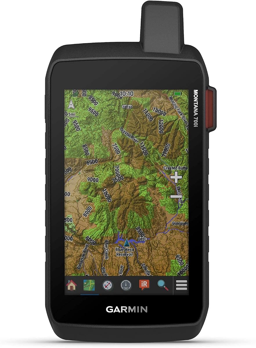
The Garmin Montana 700i is a renewed, large-screen handheld GPS with built-in inReach satellite technology. Its 4.0 rating and broad feature set make it a strong option for travelers who want a generous map display and remote communication in one device. The 5-inch glove-friendly touchscreen is especially useful for examining routes, map layers, and satellite-assisted information.
We may earn a commission when you buy through this link, at no additional cost to you.
TopoActive and City Navigator street maps are preloaded, and the navigation sensors include a 3-axis compass and barometric altimeter. Multi-GNSS support covers GPS and Galileo. Interactive SOS connects users with a 24/7 monitoring center, while two-way messaging relies on the global Iridium satellite network and requires an active subscription.
ANT+ technology, Wi-Fi, Bluetooth, BirdsEye Satellite Imagery downloads, location sharing, and Connect IQ support broaden the device's connected functions. The rugged military-grade construction and glove-friendly screen suit demanding outdoor use. As a renewed model, its condition may differ from a new unit, and satellite communications remain subject to service and legal restrictions. It also has fewer listed satellite systems than the GPSMAP 67i.
The Montana 700i is best for hikers, off-road travelers, and expedition users who prioritize screen size and satellite messaging together. It is less suitable for those wanting a compact unit or a long-established mapping ecosystem without a renewed listing. The Montana 710 offers broader optional mapping and multi-band positioning, making the choice depend on whether communication or expanded navigation capability matters more.
The combination of inReach messaging and a 5-inch display offers an effective balance between remote communication and route visibility. Users can send two-way messages, initiate interactive SOS, and still inspect detailed maps without working with a very small screen.
Wi-Fi, Bluetooth, ANT+, BirdsEye downloads, and Connect IQ support extend the navigator beyond standalone mapping. Garmin Explore compatibility helps with routes, waypoints, activities, tracks, and collections, although an active satellite subscription is needed for the core communication functions.
We may earn a commission when you buy through this link, at no additional cost to you.
The right handheld GPS depends on the terrain, pace of travel, navigation style, and need for communication. Use the following factors to compare screen usability, satellite reception, mapping depth, durability, power, and connected features before choosing a model.
Screen size affects how comfortably a user can inspect route intersections, terrain labels, and nearby points of interest. A 2.2-inch display favors compact travel and physical controls, while 3-inch and 3.2-inch screens offer more room for touch navigation. A 5-inch screen is easier to read during vehicle-based or slower-paced trips but takes up more pack space. Sunlight readability matters even on a color display because outdoor conditions can overwhelm an ordinary panel. Touchscreens improve map panning and zooming, although physical buttons and glove-friendly operation can be safer in cold, wet, or highly mobile situations.
GPS-only receivers can work well under open skies, but multi-GNSS models support additional satellite systems such as GLONASS, Galileo, BeiDou, and QZSS. This can improve the number of visible satellites and make positioning more dependable around cliffs, dense trees, and other obstructed terrain. Multi-band GPS support offers another level of accuracy by using multiple frequency bands. The 3-axis compass and barometric altimeter are separate from satellite positioning, yet they add valuable heading and elevation information. Buyers should distinguish these positioning features from communication functions such as two-way satellite messaging.
A preloaded basemap is useful for orientation, but topographic detail determines how well a navigator supports hiking, cycling, and backcountry routes. TopoActive maps include roads, trails, terrain features, and points of interest. Internal memory and microSD expansion determine how much extra regional data can be stored, while some models support downloadable satellite imagery and optional premium content. Users should verify coverage for the countries and states they plan to visit, and any detailed maps should be downloaded before cellular or Wi-Fi access becomes unavailable.
Battery specifications need to match the length and intensity of a trip. Two AA batteries are simple to replace in the field, while internal lithium-ion batteries offer convenience and high capacity in expedition modes. Look for both normal GPS and low-power expedition figures, then consider that multi-band operation, backlight use, satellite tracking, and temperature affect actual runtime. USB-C charging is increasingly convenient, but users should plan a power reserve for extended trips. A device that can accept conventional batteries may be reassuring to travelers who prefer not to depend on a proprietary charging system.
A rugged handheld should tolerate rain, splashes, dust, vibration, and occasional impacts. IPX7 and IP67 ratings indicate meaningful water protection, with IP67 also specifying dust protection. MIL-STD-810 construction provides a broader indication that a device has been tested against specified thermal, shock, and vibration conditions. These ratings do not mean the navigator should be submerged or operated outside the manufacturer's guidance. Screen readability, sealed physical buttons, grip, and operating temperature also influence field usefulness. Buyers should consider the environment rather than relying on one ruggedness label.
A dedicated handheld GPS can keep working where a phone loses cellular service, but satellite communication adds another level of protection. Models with inReach technology support two-way messaging, location tracking, and interactive SOS through a 24/7 response center. These functions require an active service subscription, and regulations may restrict satellite devices in certain jurisdictions. For hikes close to populated areas, standard GNSS navigation is usually sufficient. For solo travel, remote work, hunting, or multi-day routes beyond reliable coverage, a two-way messaging function can be a valuable safety tool rather than merely another specification.
Wi-Fi, Bluetooth, ANT+, and smartphone app support can simplify route planning, software updates, weather access, and activity review. Garmin Explore appears across several models in this guide, while inReach-equipped units connect to a broader safety and subscription platform. Downloadable premium mapping and satellite imagery add flexibility but may require separate plans. Buyers should decide whether they want a self-contained device with maps installed or a connected system that can transfer data at home. The best option is the one whose software workflow matches the user's planning habits and field connectivity.
The best navigator is the one that can be operated quickly without losing attention on the trail. Physical buttons are dependable with wet or gloved hands, while touchscreens make map zooming and route review more intuitive. Compact units fit easily in a jacket pocket or waist pack; large screens work well from a pack lid, handlebars, or vehicle mount. Weight, grip, button spacing, and menu depth also matter over a full day. A larger device may be ideal for trip planning and slower travel but tiring to carry during fast hiking, so the intended pace of travel should guide the choice.
Before the first trip, power the unit fully, set the date and time correctly, and install or download the relevant topographic maps. Confirm that the map covers the entire route and nearby detours. Review the controls, create a waypoint at the trailhead, and learn how to return to it. If the device supports smartphone planning or Wi-Fi transfers, complete route downloads and software updates while reliable connectivity is still available.
On the trail, treat the navigator as an aid rather than the only source of information. Compare its position with the map, watch the route and track, and confirm progress at junctions. Keep the screen readable by managing the backlight and avoiding unnecessary menu use. When visibility is poor, use the compass and altimeter alongside the map, and preserve battery life by selecting an appropriate tracking or expedition mode.
After the outing, power down the unit, remove any installed batteries if the manufacturer recommends it, and keep contacts dry. Clean the screen and housing with a soft, damp cloth, avoiding harsh chemicals that could damage seals or coatings. Inspect buttons, connector covers, and mounting points for dirt or wear, and confirm that important maps and recorded tracks remain available for the next trip.
A dedicated handheld GPS can remain useful where cellular service is absent and when the phone battery is being conserved for navigation or emergencies. Dedicated devices also provide physical controls, larger outdoor-focused screens, and stronger mapping options. A smartphone can still be advantageous because it offers apps, instant geotagging, and easy photo integration, so carrying both can be sensible on remote trips.
Multi-GNSS means the receiver can use signals from more than one satellite navigation system, such as GPS, GLONASS, Galileo, BeiDou, or QZSS. Access to additional constellations can provide more visible satellites and improve positioning in difficult terrain. It does not guarantee perfect accuracy, because trees, cliffs, weather, and map quality still affect the final navigation experience.
Most models in this guide provide meaningful water protection, but the rating differs. IPX7 and IP66 are associated with resistance to water in specific test conditions, while IP67 also includes dust protection. Water resistance does not mean a device is safe for prolonged submersion, and connector covers should be closed according to the manufacturer's instructions.
Usually not, especially on a well-known trail near roads, developed campgrounds, or areas with cellular coverage. It becomes more valuable for solo hikes, backcountry routes, hunting trips, and journeys where the group may remain out of contact for many hours. Any satellite service should be activated and tested before the trip, with local regulations checked as well.
The required amount depends on the regions covered, the map style, and whether users want satellite imagery or optional content. A device with 8 GB plus a microSD slot may suit regional trips, while 32 GB and 64 GB configurations offer more flexibility for multiple countries or detailed downloads. Users should check whether additional mapping is free, subscription-based, or region-specific before departure.
Neither is universally better. Replaceable AA batteries are convenient when spare cells are easy to carry, while a rechargeable lithium-ion system is simpler for regular use and can provide longer intervals between charges. Cold conditions, high backlight use, and multi-band operation may reduce runtime, so the best choice reflects trip length, charging access, and personal packing habits.
Yes, but their intended strengths differ. The eTrex 22x and eTrex 32x include routable roads and trails suitable for cycling and hiking, while the Montana models offer larger displays and optional street or marine maps. A separate vehicle mount may be needed for in-car use, and the built-in routing should be compared with the specific roads, trails, and vehicle requirements of the trip.
Yes, offline preparation is essential for any route beyond reliable cellular coverage. Download the relevant regional maps, confirm their zoom detail, and open the route before leaving. The S190 specifically notes a limited zoom tier in its preloaded state maps, making advance download instructions particularly important. Carrying a paper map and compass remains a sensible additional precaution.
The Garmin eTrex 22x offers the strongest balance of simplicity, mapping, size, and battery convenience, making it the best overall choice for typical hikers and cyclists. The Garmin eTrex Touch is the leading touchscreen option for users who want modern controls and multi-band positioning in a compact body. For buyers seeking a premium field experience, the Garmin Montana 710 provides a large glove-friendly display, satellite imagery, extensive mapping options, and serious environmental durability.
Prioritize the requirements that will affect every trip: readable mapping, reliable positioning, sufficient offline storage, appropriate battery runtime, and controls that remain usable in the expected weather. Remote travelers should also evaluate satellite messaging, but only after confirming service requirements and regulations. Compact eTrex models remain excellent when carrying weight and simplicity matter, whereas large Montana and GPSMAP devices make more sense when mapping detail, planning tools, and emergency communication deserve extra space.
Specifications, included content, availability, and commercial terms can change, so buyers should verify the current listing and regional map support before ordering. Taking time to download detailed maps, learn the controls, and test the device before departure will contribute more to a successful outing than any single headline specification.